Research Using Artificial Intelligence
Rock glacier inventory for the Tibetan Plateau
Zhangyu (Joe) Sun, PhD student
This research compiles a comprehensive inventory of rock glaciers across the Tibetan Plateau, i.e., TPRoGI (v1.0) using an innovative deep learning method. This inventory consists of a total of 44 273 rock glaciers, covering approximately 6000 km2, with a mean area of 0.14 km2. This inventory serves as a benchmark dataset and constitutes a significant contribution towards understanding, future monitoring, and assessment of permafrost on the Tibetan Plateau in the context of climate change. The dataset is available at https://doi.org/10.5281/zenodo.10732042 (Sun et al., 2024a).
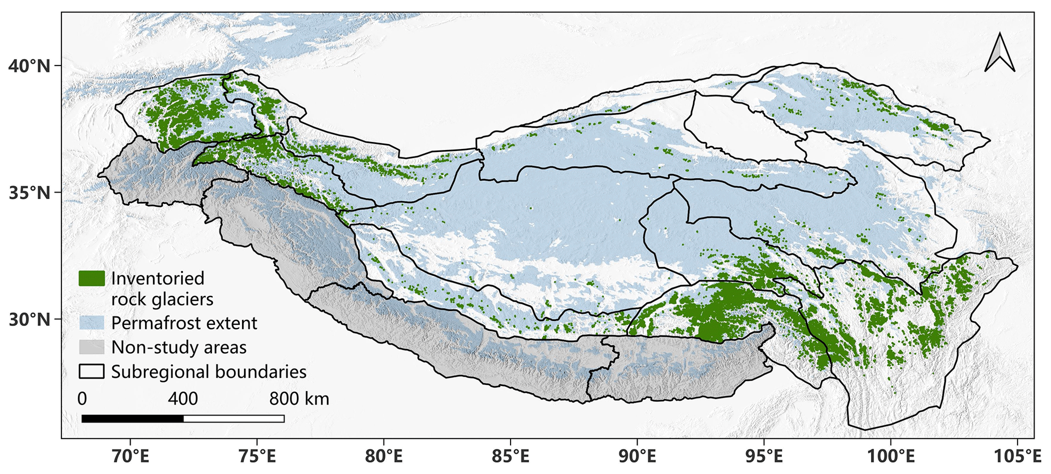
Rock glacier inventory (TPRoGI) on the Tibetan Plateau.
Revealing Supraglacial Hydrology of the Greenland Ice Sheet Using Deep Learning
Wensong (Bill) Zhang, PhD Student
In recent two decades, the Greenland Ice Sheet is the largest single contributor to global sea level rise, and this contribution is dominated by surface meltwater runoff. Surface meltwater is routed and (transiently) stored by a diverse and complex supraglacial hydrological system, including supraglacial rivers, lakes, water-filled crevasses, slushes, and moulins. Until now, the distribution and evolution of these features a badly constrained, since it is challenging to map them from satellite imagery due to their narrow width (except for supraglacial lakes). This project plans to develop the first fully automated method to collectively map all these hydrologic features using Deep Learning.
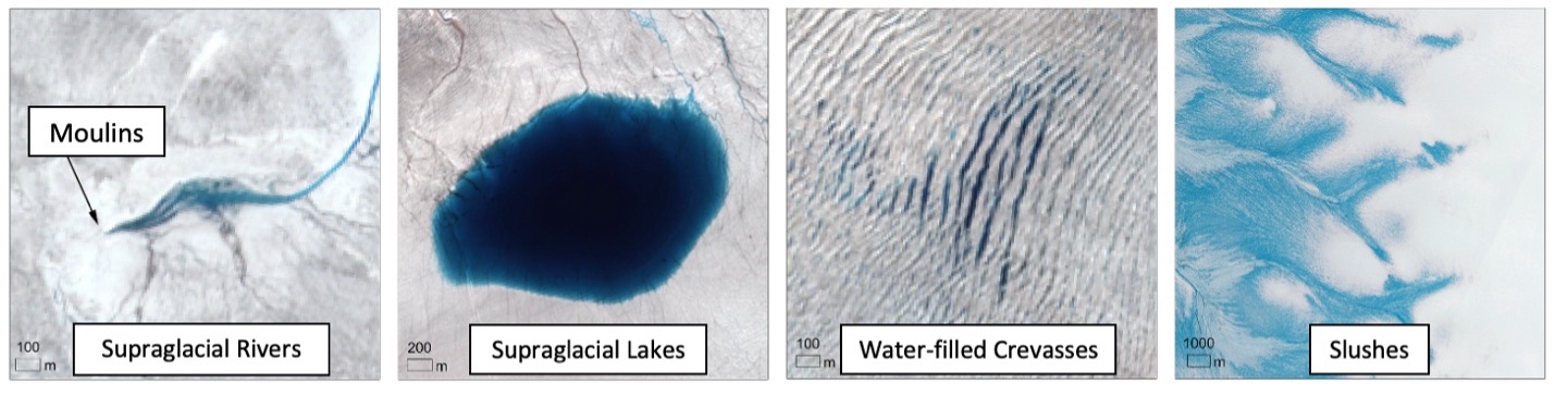
From left to right: Sentinel-2 false color composite (10 m resolution) for different components of Greenland surface hydrology, including supraglacial rivers and moulins, supraglacial lakes, water-filled crevasses, and slushes.
Thermokarst landforms on the Tibetan Plateau
Summer Xia (PhD student) and Lingcao Huang (former postdoc, now RAP @ CUHK)
This research focuses on the distribution of thermokarst landforms, including thaw slumps (the figure below) and thermal erosion gullies, on the Tibetan Plateau and the factors affecting them. In many permafrost areas, warming and thawing of ground result in distinct thermokarst landforms in remote and isolated regions. We apply image processing methods, including deep learning algorithm, to multi-source remote sensing data, aiming to map these landforms automatically. We also analyze the spatial-temporal changes of the mapped landforms and investigates the driving factors of their evolution by integrating other data such as digital elevation model and meteorological data.
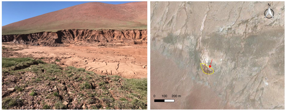
Left: Ground photo of a thaw slump in Beiluhe, Tibet; Right: Planet CubeSat image © 2018 Planet Labs Inc. The yellow line outlines the thaw slump, and the red arrow indicates the position and looking direction of the ground photo.
This research is funded by the Hong Kong Research Grants Council (Projects CUHK14300815 and CUHK14303119).